Hoang Sa – Truong Sa exhibition comes to Nghe An
Latest
| TIN LIÊN QUAN | |
| Climbing up Thoi Loi mountain in Ly Son Island | |
| Nguyen dynasty’s woodblocks on Hoang Sa, Truong Sa sovereignty displayed | |
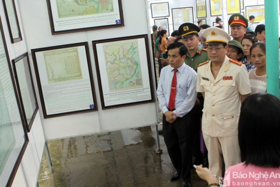
On display are 154 documents issued by Vietnamese feudal dynasties from the 17th to the early 20th century, ancient maps published by Vietnam, western countries and China relating to Vietnam’s sovereignty over the two archipelagos as well as the country’s exercise of the sovereignty before 1975.
 |
| Vistors to the exhibition. (Photo: baonghean.vn) |
Of note, the exhibition introduced official documents of the Nguyen Dynasty (1802-1945) regarding Vietnam’s exploitation, management, establishment and exercise of its sovereignty over Hoang Sa and Truong Sa.
Apart from documents and publications compiled by western countries in the 18th and 19th centuries certifying that Hoang Sa and Truong Sa archipelagos belong to Vietnam, the exhibition features four atlas published by China’s Qing Dynasty and the Chinese government from 1908 to 1933 defining Hainan island as China’s southernmost point.
Anh Son district is the resting place of more than 12,000 Vietnamese volunteer soldiers and experts who laid down their lives in battlefields in Laos.
The three-day exhibition aims to contribute to raising awareness of officials, soldiers and people about national construction and defence.
 | Vietnamese in India, Nepal look towards homeland’s sea, islands The Vietnamese Embassy in India on June 26 launched a campaign themed “Looking towards the homeland’s sea and islands”. |
 | Vegetable gardens green Truong Sa archipelago Braving harsh weather conditions, naval officers and soldiers in the island district of Truong Sa, the southern central province of Khanh Hoa, still plant vegetables ... |
 | Prague exhibition introduces Vietnam’s sea, islands’ beauty An exhibition on “Vietnam: The Nation and People – View from Sea and Island” opened in Prague, the Czech Republic on July 12, aiming to ... |


